Geolocate

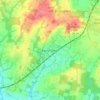
Cowfold topographic map

Click on the map to display elevation.

About this map

Name: Cowfold topographic map, elevation, terrain.

Location: Cowfold, Horsham, West Sussex, England, United Kingdom (50.96460 -0.30523 51.01414 -0.22955)

Average elevation: 32 m

Minimum elevation: 6 m

Maximum elevation: 96 m

Other topographic maps

Click on a map to view its topography, its elevation and its terrain.
Cootham

United Kingdom > England > West Sussex > Horsham > Storrington

Average elevation: 51 m

Horsham

United Kingdom > England > West Sussex > Horsham

Average elevation: 62 m

Wiggonholt

United Kingdom > England > West Sussex > Horsham > Wiggonholt

Average elevation: 17 m

Hardham

United Kingdom > England > West Sussex > Horsham > Coldwaltham

Average elevation: 13 m

Wineham

United Kingdom > England > West Sussex > Horsham

Average elevation: 18 m

Barns Green

United Kingdom > England > West Sussex > Horsham

Average elevation: 49 m

Horsham

United Kingdom > England > West Sussex > Horsham

Average elevation: 62 m

Hardham

United Kingdom > England > West Sussex > Horsham > Coldwaltham

Average elevation: 13 m

Horsham

United Kingdom > England > West Sussex > Horsham

Average elevation: 62 m

Gear up for your next adventure:

🔑Heavy Duty Carabiners - Secure gear to the outside of your pack for easy access
📱Shockproof Phone Cases - Extra protection for your smartphone against drops on rocky terrain
🧼Clip-on Hand Sanitizer - Maintain hygiene when water for washing is scarce
🪑Portable Backpacking Chairs - A comfortable seat for studying maps at the end of the day
🔪Camping Knives - Multi-purpose outdoor knives

As an Amazon Associate, this site earns from qualifying purchases at no extra cost to you.