
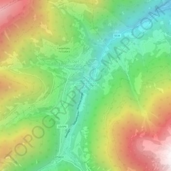
Stilfserbrücke - Ponte Stelvio topographic map
Interactive map
Click on the map to display elevation.
About this map
Name: Stilfserbrücke - Ponte Stelvio topographic map, elevation, terrain.
Average elevation: 1,582 m
Minimum elevation: 927 m
Maximum elevation: 2,526 m
Other topographic maps
Click on a map to view its topography, its elevation and its terrain.
Faslarhöfe - Fossalara
Italie > Trentin-Haut-Adige > Haut-Adige > Stilfs - Stelvio > Stilfs Dorf - Stelvio Paese
Faslarhöfe - Fossalara, Stilfs Dorf - Stelvio Paese, Stilfs - Stelvio, Vinschgau - Val Venosta, Haut-Adige, Trentin-Haut-Adige, 39029, Italie
Average elevation: 1,648 m
Ortler - Ortles
Italie > Trentin-Haut-Adige > Haut-Adige > Stilfs - Stelvio
Ortler - Ortles, Stilfs - Stelvio, Vinschgau - Val Venosta, Haut-Adige, Trentin-Haut-Adige, Italie
Average elevation: 3,181 m