Geolocate

Hallaton topographic map

Click on the map to display elevation.

About this map

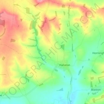
Name: Hallaton topographic map, elevation, terrain.

Location: Hallaton, Harborough, Leicestershire, England, United Kingdom (52.54541 -0.87635 52.58903 -0.81430)

Average elevation: 125 m

Minimum elevation: 74 m

Maximum elevation: 191 m

Gear up for your next adventure:

🆘Personal Locator Beacons (PLB) - Satellite emergency beacons for life-saving help in areas with no mobile coverage
🎧Bluetooth Outdoor Earbuds - Listen to navigation cues or podcasts during long solo treks
🔌Fast Charging Adapters - Quickly top up all your gear before heading back into the field
🐍Snake Gaiters - Protection against snake bites
🧢Outdoor Sun Hats - Sun protection hats for hiking

As an Amazon Associate, this site earns from qualifying purchases at no extra cost to you.