Geolocate

Bamban topographic map

Click on the map to display elevation.

About this map

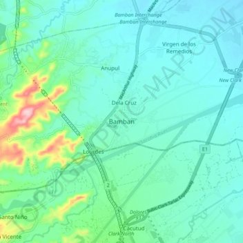
Name: Bamban topographic map, elevation, terrain.

Location: Bamban, Tarlac, Central Luzon, 2327, Philippines (15.23332 120.52727 15.31332 120.60727)

Average elevation: 86 m

Minimum elevation: 48 m

Maximum elevation: 252 m

Other topographic maps

Click on a map to view its topography, its elevation and its terrain.

Marimla River

Philippines > Tarlac > Bamban > Lourdes

Average elevation: 79 m

Gear up for your next adventure:

🧴Sunscreen SPF - Sun protection for outdoor activities
📍Handheld GPS - GPS devices for hiking and navigation
🌬️Windbreaker Jackets - Wind protection jackets
🍳Ultralight Camping Stoves - Boil water quickly for meals using minimal fuel
🎒3L Hydration Reservoirs - Hands-free drinking to stay hydrated on steep contour climbs

As an Amazon Associate, this site earns from qualifying purchases at no extra cost to you.