Geolocate

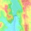
Marasandra topographic map

Click on the map to display elevation.

About this map

Name: Marasandra topographic map, elevation, terrain.

Location: Marasandra, Magadi taluku, Ramanagara District, Karnataka, 561101, India (13.14159 77.14369 13.18159 77.18369)

Average elevation: 845 m

Minimum elevation: 813 m

Maximum elevation: 931 m

Other topographic maps

Click on a map to view its topography, its elevation and its terrain.
Manchanabele

India > Karnataka > Magadi taluku

Average elevation: 771 m

Gear up for your next adventure:

👟Lightweight Trail Runners - Agile footwear for fast movement over rugged Australian terrain
🧊Insulated Stainless Steel Flasks - Keep water cold for 24 hours in the heat or coffee hot in the cold
🥾Heavy Duty Hiking Boots - Ankle-supporting boots for carrying heavy packs on steep contours
🔦LED Torches - LED torches for outdoor use
🛌Sleeping Mats - Insulated mats for camping comfort

As an Amazon Associate, this site earns from qualifying purchases at no extra cost to you.