Geolocate

Sabarimala topographic map

Click on the map to display elevation.

About this map

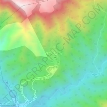
Name: Sabarimala topographic map, elevation, terrain.

Location: Sabarimala, Konni, Pathanamthitta, Kerala, India (9.41663 77.06043 9.45663 77.10043)

Average elevation: 477 m

Minimum elevation: 159 m

Maximum elevation: 1,083 m

Other topographic maps

Click on a map to view its topography, its elevation and its terrain.

Aruvappulam

India > Kerala > Konni

Average elevation: 519 m

Gurunathanmannu

India > Kerala > Konni

Average elevation: 724 m

Gear up for your next adventure:

🔋Solar Power Banks - Charge your phone and GPS using the sun while deep in the bush
🛌Sleeping Bags - Sleeping bags for outdoor camping
🥾Hiking Gaiters - Leg protection for trails
🧼Clip-on Hand Sanitizer - Maintain hygiene when water for washing is scarce
🔥Windproof Plasma Lighters - USB rechargeable lighters that work in high-altitude winds

As an Amazon Associate, this site earns from qualifying purchases at no extra cost to you.