Geolocate

Moneystone topographic map

Click on the map to display elevation.

About this map
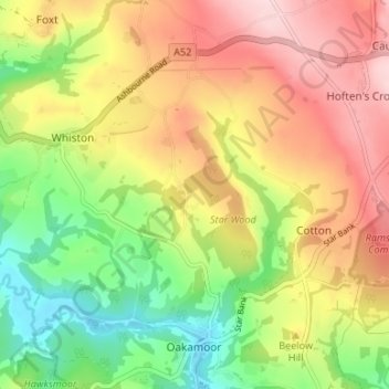
Name: Moneystone topographic map, elevation, terrain.

Location: Moneystone, Oakamoor, Cotton, Staffordshire Moorlands, Staffordshire, England, ST10 3DX, United Kingdom (52.99621 -1.94272 53.03621 -1.90272)

Average elevation: 231 m

Minimum elevation: 109 m

Maximum elevation: 357 m

Gear up for your next adventure:

👖Convertible Hiking Trousers - Zip-off legs to adapt to changing temperatures throughout the day
💡Collapsible Camping Lanterns - Illuminate your base camp or tent for map studying at night
🎧Bluetooth Outdoor Earbuds - Listen to navigation cues or podcasts during long solo treks
🧥Packable Rain Jackets - Breathable waterproof layers for unpredictable mountain weather
🩹Blister Prevention Tape - Apply to friction points before they become painful sores

As an Amazon Associate, this site earns from qualifying purchases at no extra cost to you.