Geolocate

Samaguri topographic map

Click on the map to display elevation.

About this map
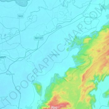
Name: Samaguri topographic map, elevation, terrain.

Location: Samaguri, Nagaon, Assam, India (26.21436 92.69993 26.49385 92.96541)

Average elevation: 139 m

Minimum elevation: 58 m

Maximum elevation: 843 m

Gear up for your next adventure:

👕UPF 50+ Sun Shirts - Essential protection against the harsh Australian sun during field work
🕯️Emergency Whistles - Safety whistles for hiking
🧼Biodegradable Soap - Eco-friendly outdoor soap
🗺️Topographic Maps - Detailed maps for hiking and navigation
🐍Australian Snake Bite Kits - Specific pressure immobilization bandages for Australian venomous snakes

As an Amazon Associate, this site earns from qualifying purchases at no extra cost to you.