Geolocate

Mansfield topographic map

Click on the map to display elevation.

About this map
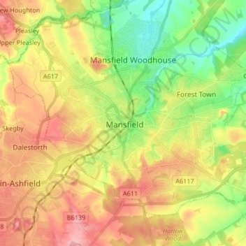
Name: Mansfield topographic map, elevation, terrain.

Location: Mansfield, Nottinghamshire, East Midlands, England, NG18 1HR, United Kingdom (53.10477 -1.23734 53.18477 -1.15734)

Average elevation: 128 m

Minimum elevation: 64 m

Maximum elevation: 197 m

Gear up for your next adventure:

🎒40L Day Hiking Backpacks - Comfortable packs with hydration support for long days exploring topographic peaks
🔋Rechargeable Batteries - Eco-friendly power for high-drain GPS units and flashlights
📷Backpack Camera Clips - Quick access to your camera while keeping your hands free for climbing
🧊Insulated Stainless Steel Flasks - Keep water cold for 24 hours in the heat or coffee hot in the cold
📡Portable Emergency Radios - Stay informed about weather warnings and bushfire alerts

As an Amazon Associate, this site earns from qualifying purchases at no extra cost to you.