Geolocate

The Bridge topographic map

Click on the map to display elevation.

About this map

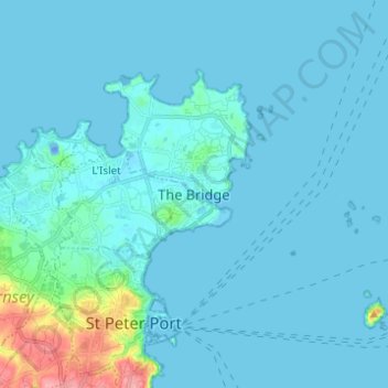
Name: The Bridge topographic map, elevation, terrain.

Location: The Bridge, St Sampson, Guernsey, GY2 4PB, Guernsey (49.44332 -2.55987 49.52332 -2.47987)

Average elevation: 8 m

Minimum elevation: -23 m

Maximum elevation: 93 m

Gear up for your next adventure:

🧴SPF 50+ Bulk Sunscreen - Maximum protection for long-term outdoor exposure
🔦Powerful LED Headlamps - Hands-free lighting for night navigation and setting up camp after dark
🥤Hydration Packs - Hydration systems for hiking
🏃Compression Recovery Socks - Reduce leg fatigue after heavy days of elevation gain
🦯Trekking Poles - Walking poles for hiking stability

As an Amazon Associate, this site earns from qualifying purchases at no extra cost to you.