Geolocate

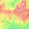
Schomberg topographic map

Click on the map to display elevation.

About this map

Name: Schomberg topographic map, elevation, terrain.

Location: Schomberg, King, York Region, Golden Horseshoe, Ontario, L0G 1T0, Canada (43.98139 -79.70254 44.02139 -79.66254)

Average elevation: 243 m

Minimum elevation: 219 m

Maximum elevation: 282 m

Other topographic maps

Click on a map to view its topography, its elevation and its terrain.
Holland Marsh

Canada > Ontario > York Region > King

Average elevation: 240 m

King—Vaughan

Canada > Ontario > York Region > King

Average elevation: 265 m

Bell's Lake

Canada > Ontario > York Region > King

Average elevation: 295 m

Kettle Lake Park

Canada > Ontario > York Region > King > King City

Average elevation: 294 m

Gear up for your next adventure:

⌛Survival Blankets - Emergency thermal blankets
💡Collapsible Camping Lanterns - Illuminate your base camp or tent for map studying at night
🛰️Handheld GPS Units - Rugged GPS devices for tracking coordinates and elevation in the Australian bush
🚴Cycling Backpacks - Backpacks for cyclists
📚Map Reading & Navigation Guides - Master the art of interpreting topographic contours and symbols

As an Amazon Associate, this site earns from qualifying purchases at no extra cost to you.