
BS1 topographic map
Interactive map
Click on the map to display elevation.
About this map
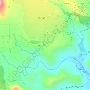
Name: BS1 topographic map, elevation, terrain.
Location: BS1, Yaté, South Province, New Caledonia, 98834, France (-22.29729 166.94737 -22.29701 166.94805)
Average elevation: 156 m
Minimum elevation: 66 m
Maximum elevation: 315 m
Other topographic maps
Click on a map to view its topography, its elevation and its terrain.
BS2
France > South Province > Yaté
BS2, CIM-MIA, Yaté, South Province, New Caledonia, 98834, France
Average elevation: 162 m