
St. Georgen im Schwarzwald topographic map
Interactive map
Click on the map to display elevation.
About this map
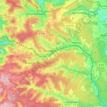
Name: St. Georgen im Schwarzwald topographic map, elevation, terrain.
Average elevation: 865 m
Minimum elevation: 675 m
Maximum elevation: 1,045 m
Other topographic maps
Click on a map to view its topography, its elevation and its terrain.
Villingen-Schwenningen
Germany > Baden-Württemberg > Schwarzwald-Baar-Kreis
Villingen-Schwenningen, Verwaltungsgemeinschaft Villingen-Schwenningen, Schwarzwald-Baar-Kreis, Baden-Württemberg, Germany
Average elevation: 751 m