
Gourbesville topographic map
Interactive map
Click on the map to display elevation.
About this map
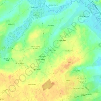
Name: Gourbesville topographic map, elevation, terrain.
Average elevation: 16 m
Minimum elevation: 0 m
Maximum elevation: 32 m
Other topographic maps
Click on a map to view its topography, its elevation and its terrain.
Agon-Coutainville
Agon-Coutainville, Coutances, Manche, Normandie, France métropolitaine, 50230, France
Average elevation: 13 m
Cherbourg-en-Cotentin
Cherbourg-en-Cotentin, Cherbourg, Manche, Normandie, France métropolitaine, France
Average elevation: 67 m
Les Planchettes
France > Normandie > Manche > Saint-Laurent-de-Cuves > Les Planchettes
Les Planchettes, Saint-Laurent-de-Cuves, Avranches, Manche, Normandie, France métropolitaine, 50670, France
Average elevation: 73 m