Geolocate

Dingin topographic map

Click on the map to display elevation.

About this map

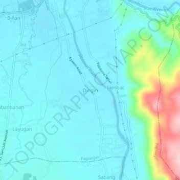
Name: Dingin topographic map, elevation, terrain.

Location: Dingin, Pagsanjan, Laguna, Calabarzon, 4008, Philippines (14.22760 121.43274 14.26760 121.47274)

Average elevation: 44 m

Minimum elevation: -2 m

Maximum elevation: 264 m

Gear up for your next adventure:

🧦Merino Wool Hiking Socks - Moisture-wicking socks to prevent blisters during long topographic surveys
🦯Adjustable Trekking Poles - Reduce impact on knees when descending steep topographic ridges
📡Portable Emergency Radios - Stay informed about weather warnings and bushfire alerts
🌧️Rain Jackets - Waterproof jackets for hiking
📦Crushproof Equipment Cases - Safe transport for sensitive surveying and mapping instruments

As an Amazon Associate, this site earns from qualifying purchases at no extra cost to you.