
Slikkerveer topographic map
Interactive map
Click on the map to display elevation.
About this map
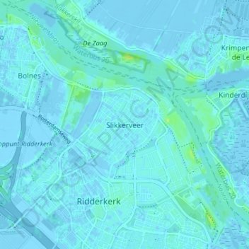
Name: Slikkerveer topographic map, elevation, terrain.
Average elevation: 1 m
Minimum elevation: -4 m
Maximum elevation: 12 m
Other topographic maps
Click on a map to view its topography, its elevation and its terrain.
Ridderkerk
Nederland > Zuid-Holland > Ridderkerk
Ridderkerk, Zuid-Holland, Nederland
Average elevation: 1 m
Rijsoord
Nederland > Zuid-Holland > Ridderkerk
Rijsoord, Ridderkerk, Zuid-Holland, Nederland, 2988 AK, Nederland
Average elevation: 0 m
Bolnes
Nederland > Zuid-Holland > Ridderkerk
Bolnes, Ridderkerk, Zuid-Holland, Nederland, 2987 CW, Nederland
Average elevation: 1 m