
Callería topographic map
Interactive map
Click on the map to display elevation.
About this map
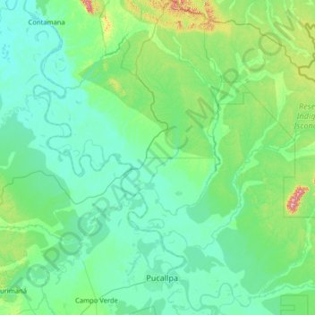
Name: Callería topographic map, elevation, terrain.
Location: Callería, Provincia de Coronel Portillo, Ucayali, Perú (-8.53177 -74.69649 -7.26205 -73.52600)
Average elevation: 188 m
Minimum elevation: 120 m
Maximum elevation: 775 m
Other topographic maps
Click on a map to view its topography, its elevation and its terrain.