
Iribas topographic map
Interactive map
Click on the map to display elevation.
About this map
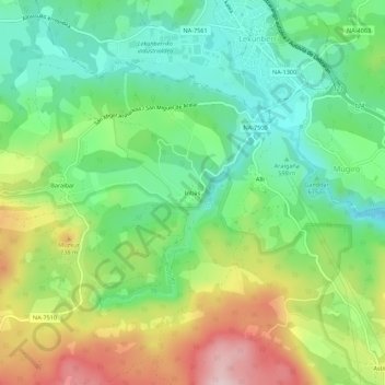
Name: Iribas topographic map, elevation, terrain.
Location: Iribas, Larraun, Larraun-Leitzaldea, Navarre, 31870, Espagne (42.96913 -1.92505 43.00913 -1.88505)
Average elevation: 646 m
Minimum elevation: 533 m
Maximum elevation: 835 m
Other topographic maps
Click on a map to view its topography, its elevation and its terrain.