
Balazuègnes topographic map
Interactive map
Click on the map to display elevation.
About this map
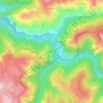
Name: Balazuègnes topographic map, elevation, terrain.
Average elevation: 806 m
Minimum elevation: 580 m
Maximum elevation: 1,061 m
Other topographic maps
Click on a map to view its topography, its elevation and its terrain.
Mijavols
France > Occitanie > Lozère > Cans et Cévennes > Saint-Julien-d'Arpaon
Mijavols, Saint-Julien-d'Arpaon, Cans et Cévennes, Florac, Lozère, Occitanie, France métropolitaine, 48400, France
Average elevation: 1,038 m