
Maienfeld topographic map
Interactive map
Click on the map to display elevation.
About this map
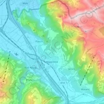
Name: Maienfeld topographic map, elevation, terrain.
Location: Maienfeld, Landquart, Grisons, 7304, Suisse (46.96870 9.51021 47.06515 9.63654)
Average elevation: 1,011 m
Minimum elevation: 471 m
Maximum elevation: 2,564 m