
La Mothe topographic map
Interactive map
Click on the map to display elevation.
About this map
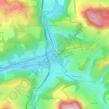
Name: La Mothe topographic map, elevation, terrain.
Average elevation: 655 m
Minimum elevation: 512 m
Maximum elevation: 927 m
Other topographic maps
Click on a map to view its topography, its elevation and its terrain.
Banassac
France > Occitanie > Lozère > Banassac-Canilhac
Banassac, Banassac-Canilhac, Mende, Lozère, Occitanie, France métropolitaine, 48500, France
Average elevation: 706 m