
Make a donation
Gear up for your next adventure:
As an Amazon Associate, this site earns from qualifying purchases at no extra cost to you.
Red Deer Lake topographic map
Click on the map to display elevation.
Make a donation
Gear up for your next adventure:
As an Amazon Associate, this site earns from qualifying purchases at no extra cost to you.
About this map
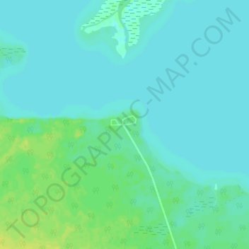
Name: Red Deer Lake topographic map, elevation, terrain.
Average elevation: 262 m
Minimum elevation: 258 m
Maximum elevation: 274 m
Make a donation
Gear up for your next adventure:
As an Amazon Associate, this site earns from qualifying purchases at no extra cost to you.
Other topographic maps
Click on a map to view its topography, its elevation and its terrain.
Peguis First Nation
Canada > Manitoba > Unorganized Division No. 19 > Dallas/Red Rose
Average elevation: 247 m
Fisher River Cree Nation
Canada > Manitoba > Unorganized Division No. 19 > Dallas/Red Rose
Average elevation: 226 m
Make a donation
Gear up for your next adventure:
As an Amazon Associate, this site earns from qualifying purchases at no extra cost to you.
Swan Lake
Canada > Manitoba > Unorganized Division No. 19
The Swan Lake drainage basin covers 3,880 square miles (10,000 km2) and extends into the province of Saskatchewan. It is located between the Duck Mountains and the Porcupine Hills. Two major rivers discharge into Swan Lake from the basin, the Swan River and the Woody River. Other topographic features include…
Average elevation: 269 m
Make a donation
Gear up for your next adventure:
As an Amazon Associate, this site earns from qualifying purchases at no extra cost to you.