
芦山县 topographic map
Interactive map
Click on the map to display elevation.
About this map
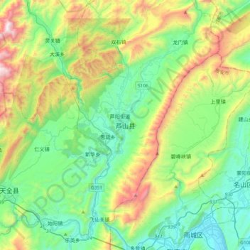
Name: 芦山县 topographic map, elevation, terrain.
Location: 芦山县, 雅安市, 四川省, 中国 (29.98748 102.77240 30.30748 103.09240)
Average elevation: 1,030 m
Minimum elevation: 545 m
Maximum elevation: 2,233 m
Other topographic maps
Click on a map to view its topography, its elevation and its terrain.