
Taylors Hill topographic map
Interactive map
Click on the map to display elevation.
About this map
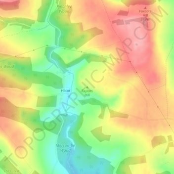
Name: Taylors Hill topographic map, elevation, terrain.
Average elevation: 237 m
Minimum elevation: 174 m
Maximum elevation: 291 m
Other topographic maps
Click on a map to view its topography, its elevation and its terrain.
Moreton-in-Marsh
United Kingdom > England > Gloucestershire > Cotswold District
Average elevation: 135 m
Cirencester
United Kingdom > England > Gloucestershire > Cotswold District > Cirencester
On Cotswold Avenue is the site of a Roman amphitheatre which, while buried, retains its shape in the earthen topography of the small park setting. Cirencester was one of the most substantial cities of Roman-era Britain.
Average elevation: 128 m