Geolocate

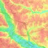
Pearsons Corner topographic map

Click on the map to display elevation.

About this map

Name: Pearsons Corner topographic map, elevation, terrain.

Location: Pearsons Corner, Mimosa Hills, Hanover County, Virginia, 23116, United States (37.66653 -77.39054 37.68653 -77.37054)

Average elevation: 55 m

Minimum elevation: 29 m

Maximum elevation: 66 m

Other topographic maps

Click on a map to view its topography, its elevation and its terrain.
Ashland

United States > Virginia > Hanover County

Average elevation: 66 m

Ashland

United States > Virginia > Hanover County

Average elevation: 66 m

Gear up for your next adventure:

🧴SPF 50+ Bulk Sunscreen - Maximum protection for long-term outdoor exposure
📡Weather Radios - Emergency weather radios
🔦LED Torches - LED torches for outdoor use
🔦Powerful LED Headlamps - Hands-free lighting for night navigation and setting up camp after dark
🔋Solar Power Banks - Solar chargers for outdoors

As an Amazon Associate, this site earns from qualifying purchases at no extra cost to you.