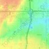
Newalla topographic map
Click on the map to display elevation.
Newalla
Newalla, with a current elevation of 1,148 feet, is located within the Eastern bounds of Oklahoma County and appears on the Harrah, Oklahoma U.S. Geological Survey Map due to their proximity. Newalla is a geographic area which spans unincorporated Oklahoma County and unincorporated Cleveland County (also referred to as Little Axe). Portions of Newalla are also within Oklahoma City Limits. School districts that provide educational services to the community are the following: McLoud Public Schools, Harrah Public School, Choctaw Public Schools, Little Axe Public Schools, Mid-Del Public Schools, as well as Norman and Moore Public Schools. The estimated population of Newalla, Oklahoma is currently at 9,514.
About this map

Name: Newalla topographic map, elevation, terrain.
Average elevation: 343 m
Minimum elevation: 324 m
Maximum elevation: 368 m
Other topographic maps
Click on a map to view its topography, its elevation and its terrain.