Geolocate

Solitude topographic map

Click on the map to display elevation.

About this map

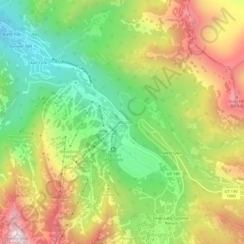
Name: Solitude topographic map, elevation, terrain.

Location: Solitude, Salt Lake County, Utah, United States (40.60025 -111.61190 40.64025 -111.57190)

Average elevation: 2,706 m

Minimum elevation: 2,325 m

Maximum elevation: 3,181 m

Gear up for your next adventure:

🗺️Topographic Maps - Detailed maps for hiking and navigation
🐍Australian Snake Bite Kits - Specific pressure immobilization bandages for Australian venomous snakes
🧥Down Jackets - Insulated jackets for cold weather
📣High-Decibel Survival Whistles - Signaling tool for rescue that carries much further than a human voice
Survival Blankets - Emergency thermal blankets

As an Amazon Associate, this site earns from qualifying purchases at no extra cost to you.