
Thank you for supporting this site ❤️
Make a donation
Make a donation
Gear up for your next adventure:
As an Amazon Associate, this site earns from qualifying purchases at no extra cost to you.
Pueblo topographic map
Click on the map to display elevation.
Thank you for supporting this site ❤️
Make a donation
Make a donation
Gear up for your next adventure:
As an Amazon Associate, this site earns from qualifying purchases at no extra cost to you.
About this map
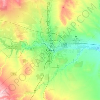
Name: Pueblo topographic map, elevation, terrain.
Location: Pueblo, Pueblo County, Colorado, 81003, United States (38.09445 -104.76914 38.41445 -104.44914)
Average elevation: 1,509 m
Minimum elevation: 1,379 m
Maximum elevation: 1,767 m
Thank you for supporting this site ❤️
Make a donation
Make a donation
Gear up for your next adventure:
As an Amazon Associate, this site earns from qualifying purchases at no extra cost to you.