Geolocate

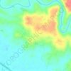
Cibongas topographic map

Click on the map to display elevation.

About this map

Name: Cibongas topographic map, elevation, terrain.

Location: Cibongas, Tasikmalaya, West Java, Java, Indonesia (-7.68049 108.25251 -7.64049 108.29251)

Average elevation: 217 m

Minimum elevation: 164 m

Maximum elevation: 310 m

Other topographic maps

Click on a map to view its topography, its elevation and its terrain.

Cipatujah

Indonesia > West Java > Tasikmalaya

Average elevation: 165 m

Cipanas

Indonesia > West Java > Tasikmalaya

Average elevation: 117 m

Desa Arjasari

Indonesia > West Java > Tasikmalaya

Average elevation: 454 m

Desa Cimanuk

Indonesia > West Java > Tasikmalaya

Average elevation: 32 m

Gear up for your next adventure:

🚁Camera Drones with GPS - Capture aerial views of the landscape to compare with topo maps
👣Snake & Scrub Gaiters - Protection against spinifex, mud, and snakes while walking off-track
🏕️Camping Gear - Essential camping equipment
📱Shockproof Phone Cases - Extra protection for your smartphone against drops on rocky terrain
🍳Camping Cookware - Cookware sets for outdoor meals

As an Amazon Associate, this site earns from qualifying purchases at no extra cost to you.