
Unterwasser topographic map
Interactive map
Click on the map to display elevation.
About this map
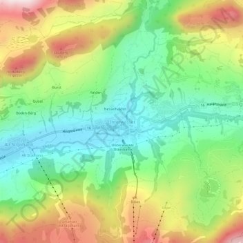
Name: Unterwasser topographic map, elevation, terrain.
Average elevation: 1,172 m
Minimum elevation: 888 m
Maximum elevation: 1,616 m
Das zweithöchstgelegene Dorf im Toggenburg liegt in der Talebene von Alt St. Johann am Zusammenfluss der Säntis- und der Wildhuserthur eingebettet zwischen dem Alpstein und den sieben Churfirsten auf einer Höhe von 910 m ü. M.
Other topographic maps
Click on a map to view its topography, its elevation and its terrain.
Wildhaus
Schweiz > Sankt Gallen > Wahlkreis Toggenburg > Wildhaus-Alt St. Johann
Wildhaus, Wildhaus-Alt St. Johann, Wahlkreis Toggenburg, Sankt Gallen, 9658, Schweiz
Average elevation: 1,244 m