Geolocate

Mount Lebanon topographic map

Click on the map to display elevation.

Mount Lebanon

Mount Lebanon (Arabic: جَبَل لُبْنَان, jabal lubnān, Levantine Arabic pronunciation: [ˈʒabal lɪbˈneːn]; Syriac: ܛܘܪ ܠܒ݂ܢܢ, ṭūr leḇnān, Syriac pronunciation: [tˤur lewˈnɔn], ṭūr lewnōn) is a mountain range in Lebanon. It averages above 2,500 m (8,200 ft) in elevation, with its peak at 3,088 m (10,131 ft).

Wikipedia (CC-BY-SA 3.0)

About this map

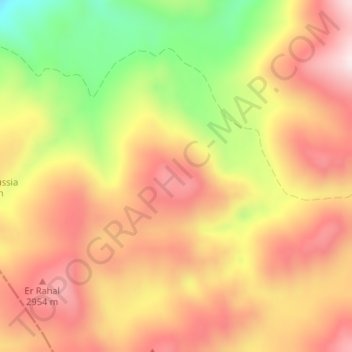
Name: Mount Lebanon topographic map, elevation, terrain.

Location: Mount Lebanon, Miniyeh-Danniyeh District, North Governorate, Lebanon (34.28995 36.09195 34.29005 36.09205)

Average elevation: 2,819 m

Minimum elevation: 2,555 m

Maximum elevation: 3,003 m

Other topographic maps

Click on a map to view its topography, its elevation and its terrain.

Batroun

Lebanon > North Governorate

Average elevation: 31 m

Gear up for your next adventure:

🧰Survival Kits - Essential survival gear
📡Weather Radios - Emergency weather radios
🎒Dry Bags - Waterproof bags for outdoor gear
🕶️Polarized Outdoor Sunglasses - Reduce glare from rocks and water for better visual navigation
👄SPF Lip Balm - Prevent sun and wind-burnt lips on mountain ridges

As an Amazon Associate, this site earns from qualifying purchases at no extra cost to you.