
Capella topographic map
Interactive map
Click on the map to display elevation.
About this map
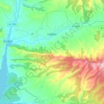
Name: Capella topographic map, elevation, terrain.
Location: Capella, La Ribagorza, Huesca, Aragon, Spain (42.13901 0.35960 42.21927 0.49501)
Average elevation: 623 m
Minimum elevation: 442 m
Maximum elevation: 1,094 m