Geolocate

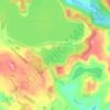
Whatoro topographic map

Click on the map to display elevation.

About this map

Name: Whatoro topographic map, elevation, terrain.

Location: Whatoro, Kaipara District, Northland, New Zealand (-35.69633 173.71073 -35.69623 173.71083)

Average elevation: 522 m

Minimum elevation: 282 m

Maximum elevation: 697 m

Other topographic maps

Click on a map to view its topography, its elevation and its terrain.

Wairoa River

New Zealand > Northland > Kaipara District

Average elevation: 42 m

Lake Kaiiwi

New Zealand > Northland > Kaipara District

Average elevation: 79 m

Lake Rototuna

New Zealand > Northland > Kaipara District

Average elevation: 120 m

Wairoa River

New Zealand > Northland > Kaipara District

Average elevation: 42 m

Gear up for your next adventure:

👣Snake & Scrub Gaiters - Protection against spinifex, mud, and snakes while walking off-track
🎒Hiking Backpacks - Backpacks designed for hiking and trekking
📡Portable Emergency Radios - Stay informed about weather warnings and bushfire alerts
👖Convertible Hiking Trousers - Zip-off legs to adapt to changing temperatures throughout the day
🐍Australian Snake Bite Kits - Specific pressure immobilization bandages for Australian venomous snakes

As an Amazon Associate, this site earns from qualifying purchases at no extra cost to you.