Geolocate

Potton topographic map

Click on the map to display elevation.

About this map
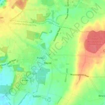
Name: Potton topographic map, elevation, terrain.

Location: Potton, Central Bedfordshire, England, United Kingdom (52.11630 -0.23801 52.14477 -0.16179)

Average elevation: 52 m

Minimum elevation: 26 m

Maximum elevation: 85 m

Gear up for your next adventure:

🐍Snake Gaiters - Protection against snake bites
📕Hiking Guide Books - Guides for hiking trails
🖼️Scratch-off Australia Map - Track the regions and peaks you have explored geographically
🧊Insulated Cooler Bags - Keep food fresh for day trips to remote geographic sites
🔋Solar Power Banks - Charge your phone and GPS using the sun while deep in the bush

As an Amazon Associate, this site earns from qualifying purchases at no extra cost to you.