
Kiganda topographic map
Interactive map
Click on the map to display elevation.
About this map
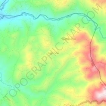
Name: Kiganda topographic map, elevation, terrain.
Location: Kiganda, Rumonge, Burundi (-3.98597 29.51559 -3.94597 29.55559)
Average elevation: 1,128 m
Minimum elevation: 907 m
Maximum elevation: 1,455 m