Geolocate

Drayton topographic map

Click on the map to display elevation.

About this map
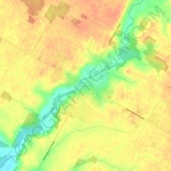
Name: Drayton topographic map, elevation, terrain.

Location: Drayton, Mapleton, Wellington County, Southwestern Ontario, Ontario, N0G 1P0, Canada (43.73506 -80.69113 43.77506 -80.65113)

Average elevation: 419 m

Minimum elevation: 391 m

Maximum elevation: 433 m

Other topographic maps

Click on a map to view its topography, its elevation and its terrain.

Conestoga Lake

Canada > Ontario > Wellington County > Mapleton

Average elevation: 412 m

Gear up for your next adventure:

🧥Insulated Down Jackets - High warmth-to-weight ratio for cold nights in the high country
🎒Ultralight Backpacks - Lightweight packs for long hikes
🛌Sleeping Mats - Insulated mats for camping comfort
🐍Snake Gaiters - Protection against snake bites
🏕️Camping Gear - Essential camping equipment

As an Amazon Associate, this site earns from qualifying purchases at no extra cost to you.