
Drajna topographic map
Interactive map
Click on the map to display elevation.
About this map
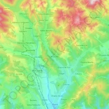
Name: Drajna topographic map, elevation, terrain.
Location: Drajna, Ploiești, Prahova, 107144, Romania (45.20776 26.03137 45.34389 26.07884)
Average elevation: 586 m
Minimum elevation: 354 m
Maximum elevation: 1,070 m
Other topographic maps
Click on a map to view its topography, its elevation and its terrain.