Geolocate

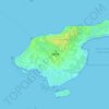
Grindsted topographic map

Click on the map to display elevation.

About this map

Name: Grindsted topographic map, elevation, terrain.

Location: Grindsted, Aalborg Municipality, North Denmark Region, 9380, Denmark (57.12894 10.02489 57.16894 10.06489)

Average elevation: 26 m

Minimum elevation: 10 m

Maximum elevation: 80 m

Other topographic maps

Click on a map to view its topography, its elevation and its terrain.

Skivum

Denmark > North Denmark Region

Average elevation: 32 m

Pebermosen

Denmark > North Denmark Region > Grindsted > Vandsted

Average elevation: 39 m

Læsø

Denmark > North Denmark Region

Average elevation: 1 m

Lindholm Høje

Denmark > North Denmark Region > Aalborg

Average elevation: 14 m

Vendsyssel

Denmark > North Denmark Region

Average elevation: 10 m

Mors

Denmark > North Denmark Region

Average elevation: 12 m

Bulbjerg

Denmark > North Denmark Region

Average elevation: 8 m

Egholm

Denmark > North Denmark Region > Aalborg

Average elevation: 1 m

Gear up for your next adventure:

🛌Compact Down Sleeping Bags - Warmth without the bulk, ideal for backcountry camping
🕯️Emergency Whistles - Safety whistles for hiking
🎽Base Layers - Thermal base layers
🔪Camping Knives - Multi-purpose outdoor knives
👕UPF 50+ Sun Shirts - Essential protection against the harsh Australian sun during field work

As an Amazon Associate, this site earns from qualifying purchases at no extra cost to you.