Geolocate

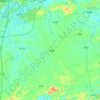
Linxu topographic map

Click on the map to display elevation.

About this map

Name: Linxu topographic map, elevation, terrain.

Location: Linxu, Nanning, Guangxi, China (23.48333 108.09106 23.56333 108.17106)

Average elevation: 247 m

Minimum elevation: 169 m

Maximum elevation: 480 m

Other topographic maps

Click on a map to view its topography, its elevation and its terrain.

Xixiangtang District

China > Guangxi > Nanning

Average elevation: 130 m

Heng County

China > Guangxi > Nanning

Average elevation: 135 m

Xingning District

China > Guangxi > Nanning

Average elevation: 191 m

Qingxiu District

China > Guangxi > Nanning

Average elevation: 140 m

Liangqing

China > Guangxi > Nanning

Average elevation: 98 m

Yongning District

China > Guangxi > Nanning

Average elevation: 118 m

Long'an County

China > Guangxi > Nanning

Average elevation: 255 m

Gear up for your next adventure:

🕶️Polarized Sunglasses - UV protection sunglasses for outdoors
📣High-Decibel Survival Whistles - Signaling tool for rescue that carries much further than a human voice
🦯Adjustable Trekking Poles - Reduce impact on knees when descending steep topographic ridges
🦘Outback Survival Gear - Essential gear for Australian outback
📟Satellite Messengers - Two-way satellite communication to stay in touch beyond the cellular grid

As an Amazon Associate, this site earns from qualifying purchases at no extra cost to you.