Geolocate

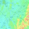
Jinji topographic map

Click on the map to display elevation.

About this map

Name: Jinji topographic map, elevation, terrain.

Location: Jinji, Laibin, Guangxi, China (23.79712 109.50033 23.87712 109.58033)

Average elevation: 79 m

Minimum elevation: 40 m

Maximum elevation: 219 m

Other topographic maps

Click on a map to view its topography, its elevation and its terrain.
Xiangzhou County

China > Guangxi > Laibin

Average elevation: 246 m

Gear up for your next adventure:

🧢Outdoor Sun Hats - Sun protection hats for hiking
🧦Merino Wool Hiking Socks - Moisture-wicking socks to prevent blisters during long topographic surveys
🎧Bluetooth Outdoor Earbuds - Listen to navigation cues or podcasts during long solo treks
🎒3L Hydration Reservoirs - Hands-free drinking to stay hydrated on steep contour climbs
🗺️Topographic Maps - Detailed maps for hiking and navigation

As an Amazon Associate, this site earns from qualifying purchases at no extra cost to you.