
Arroyo Negro topographic map
Interactive map
Click on the map to display elevation.
About this map
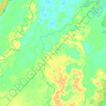
Name: Arroyo Negro topographic map, elevation, terrain.
Location: Arroyo Negro, Villa Tunari, Chapare, CBA, Bolivia (-16.53795 -65.33896 -16.38632 -65.25624)
Average elevation: 189 m
Minimum elevation: 177 m
Maximum elevation: 206 m