
黄山国家风景名胜区 topographic map
Interactive map
Click on the map to display elevation.
About this map
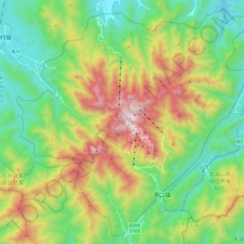
Name: 黄山国家风景名胜区 topographic map, elevation, terrain.
Location: 黄山国家风景名胜区, 黄山区, Huangshan, Anhui, 242700, China (30.05666 118.07653 30.20685 118.26137)
Average elevation: 754 m
Minimum elevation: 196 m
Maximum elevation: 1,809 m