
Thank you for supporting this site ❤️
Make a donation
Make a donation
Gear up for your next adventure:
As an Amazon Associate, this site earns from qualifying purchases at no extra cost to you.
Errington topographic map
Click on the map to display elevation.
Thank you for supporting this site ❤️
Make a donation
Make a donation
Gear up for your next adventure:
As an Amazon Associate, this site earns from qualifying purchases at no extra cost to you.
About this map
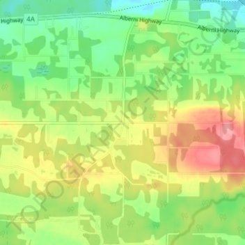
Name: Errington topographic map, elevation, terrain.
Average elevation: 120 m
Minimum elevation: 79 m
Maximum elevation: 173 m
Thank you for supporting this site ❤️
Make a donation
Make a donation
Gear up for your next adventure:
As an Amazon Associate, this site earns from qualifying purchases at no extra cost to you.
Other topographic maps
Click on a map to view its topography, its elevation and its terrain.
Englishman River Falls
Canada > British Columbia > Regional District of Nanaimo > Area F (Alberni Highway)
Average elevation: 198 m
Little Qualicum Falls Provincial Park
Canada > British Columbia > Regional District of Nanaimo > Area F (Alberni Highway)
Average elevation: 463 m