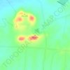
Huai'an topographic map
Click on the map to display elevation.
Huai'an
Huai'an lies on the Huai River in the alluvial Jianghuai Plain. The area is very flat with only a few notable hills in Xuyi County. The highest altitude in the municipality is 200 meters (660 ft). The area is notable for its large number of lakes, rivers, and canals. The Grand Canal connects with the Huai in the city. Hongze Lake, the fourth-largest freshwater lake in China, is southwest of the urban districts. Towards the south, there are also several smaller lakes. Huai'an is situated almost directly south of Lianyungang, southeast of Suqian, northwest of Yancheng, and north of Yangzhou and Nanjing in Jiangsu and northeast of Chuzhou in Anhui.
About this map

Name: Huai'an topographic map, elevation, terrain.
Location: Huai'an, Jiangsu, China (32.71859 118.19655 34.09580 119.64129)
Average elevation: 13 m
Minimum elevation: -2 m
Maximum elevation: 229 m
Other topographic maps
Click on a map to view its topography, its elevation and its terrain.