
碣石镇 topographic map
Interactive map
Click on the map to display elevation.
About this map
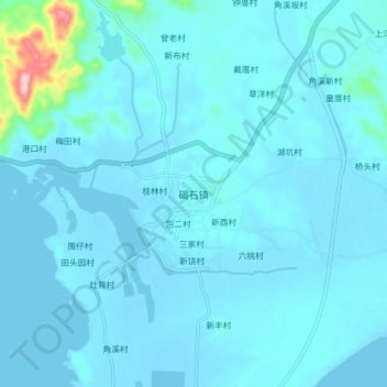
Name: 碣石镇 topographic map, elevation, terrain.
Location: 碣石镇, 陆丰市, 汕尾市, 广东省, 516545, 中国 (22.77996 115.78593 22.85996 115.86593)
Average elevation: 19 m
Minimum elevation: -3 m
Maximum elevation: 282 m
碣石一片为主要街区,平原地形,有河流自碣北起源贯穿碣石而过。
Other topographic maps
Click on a map to view its topography, its elevation and its terrain.