
Saint Helena topographic map
Interactive map
Click on the map to display elevation.
About this map
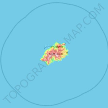
Name: Saint Helena topographic map, elevation, terrain.
Location: Saint Helena, Saint Helena, Ascension and Tristan da Cunha (-16.23000 -5.99734 -15.70400 -5.42342)
Average elevation: 12 m
Minimum elevation: 0 m
Maximum elevation: 783 m
Other topographic maps
Click on a map to view its topography, its elevation and its terrain.
Saint Helena
Saint Helena, Ascension and Tristan da Cunha > Saint Helena > Sandy Bay
Average elevation: 9 m
Jamestown
Saint Helena, Ascension and Tristan da Cunha > Saint Helena > Jamestown
Average elevation: 216 m