Geolocate

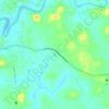
Chorode topographic map

Click on the map to display elevation.

About this map

Name: Chorode topographic map, elevation, terrain.

Location: Chorode, Vadakara, Kozhikode District, Kerala, 673106, India (11.61171 75.58038 11.65171 75.62038)

Average elevation: 18 m

Minimum elevation: 5 m

Maximum elevation: 59 m

Other topographic maps

Click on a map to view its topography, its elevation and its terrain.
Payamkuttimala

India > Kerala > Vadakara > Mandarathur

Average elevation: 26 m

Gear up for your next adventure:

🩹Wilderness First Aid Kits - Comprehensive medical kits tailored for hiking and remote exploration
🎽Base Layers - Thermal base layers
🧼Clip-on Hand Sanitizer - Maintain hygiene when water for washing is scarce
📟Satellite Messengers - Two-way satellite communication to stay in touch beyond the cellular grid
🧥Insulated Down Jackets - High warmth-to-weight ratio for cold nights in the high country

As an Amazon Associate, this site earns from qualifying purchases at no extra cost to you.