
San Pa Tong topographic map
Interactive map
Click on the map to display elevation.
About this map
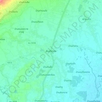
Name: San Pa Tong topographic map, elevation, terrain.
Location: San Pa Tong, Yu Wa, Chiang Mai Province, 50120, Thailand (18.58443 98.85536 18.66443 98.93536)
Average elevation: 300 m
Minimum elevation: 288 m
Maximum elevation: 359 m
Other topographic maps
Click on a map to view its topography, its elevation and its terrain.
Chiang Mai Province
Thailand > Chiang Mai Province
Chiang Mai Province is about 685 km (426 mi) from Bangkok in the Mae Ping River basin and is on average at 300 m (1,000 ft) elevation. Surrounded by the mountain ranges of the Thai highlands, it covers an area of approximately 20,107 km2 (8,000 sq mi). The mountains of the Daen Lao Range…
Average elevation: 649 m