
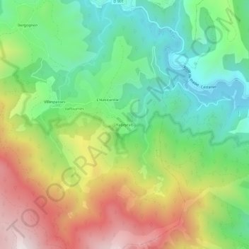
Rabeyrals topographic map
Interactive map
Click on the map to display elevation.
About this map
Name: Rabeyrals topographic map, elevation, terrain.
Average elevation: 960 m
Minimum elevation: 603 m
Maximum elevation: 1,502 m
Other topographic maps
Click on a map to view its topography, its elevation and its terrain.
La Pigeyre
France > Occitanie > Lozère > Altier
La Pigeyre, Altier, Mende, Lozère, Occitanie, France métropolitaine, 48800, France
Average elevation: 1,016 m
L'Habitarelle
France > Occitanie > Lozère > Altier > L'Habitarelle
L'Habitarelle, Altier, Mende, Lozère, Occitanie, France métropolitaine, 48800, France
Average elevation: 939 m