
Toamasina Province topographic map
Interactive map
Click on the map to display elevation.
About this map
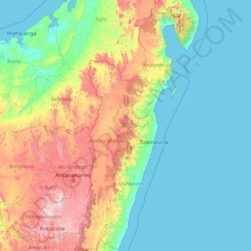
Name: Toamasina Province topographic map, elevation, terrain.
Location: Toamasina Province, Madagascar (-20.47019 47.64774 -14.88068 50.04610)
Average elevation: 408 m
Minimum elevation: -1 m
Maximum elevation: 2,528 m
Other topographic maps
Click on a map to view its topography, its elevation and its terrain.